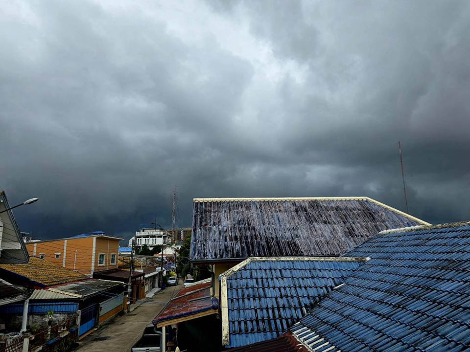
BANGKOK, Thailand – The Thai Meteorological Department has forecast continuous rainfall across Thailand, with heavy downpours in some areas, raising concerns over flash floods and potential landslides. Coastal regions in the Andaman Sea and the upper Gulf of Thailand are expected to experience strong winds and waves, prompting small boats to stay ashore. In Bangkok and surrounding areas, thunderstorms will affect 80% of the region.
Over the next 24 hours, a strong monsoon trough is expected to sweep through the lower northern, upper central, and northeastern regions of Thailand, causing widespread rain. Some areas are likely to see very heavy rainfall, particularly in the lower northern, northeastern, and upper central regions. This is due to a low-pressure system over Hainan Island, China, combined with a strong southwest monsoon covering the Andaman Sea, Thailand, and the upper Gulf of Thailand.
Areas at Risk:
Residents in these regions are advised to be cautious of heavy to very heavy rain and accumulated rainfall, which may result in flash floods or forest runoff, especially in foothill areas near waterways and low-lying zones.
Marine Warnings:
Winds and waves are expected to be strong in the Andaman Sea and upper Gulf of Thailand, with wave heights reaching 2-3 meters, and over 3 meters in stormy areas. In the lower Gulf of Thailand, waves will be about 2 meters high, rising above 2 meters during thunderstorms. Mariners are urged to proceed with caution and avoid navigating through stormy areas, while small boats should refrain from leaving shore for another day.
Northern Thailand: 70% of the region will experience thunderstorms, with heavy to very heavy rain in areas including Mae Hong Son, Chiang Mai, Chiang Rai, Lamphun, Lampang, Phayao, Nan, Phrae, Uttaradit, Tak, Sukhothai, Kamphaeng Phet, Phichit, Phitsanulok, and Phetchabun. Temperatures will range from 24-25°C to 30-32°C. Winds: Variable, 10-15 km/h.
Northeastern Thailand: 80% of the area will experience thunderstorms, with heavy to very heavy rain in Loei, Nong Khai, Bueng Kan, Nong Bua Lamphu, Udon Thani, Sakon Nakhon, Nakhon Phanom, Chaiyaphum, Khon Kaen, Kalasin, Mukdahan, Maha Sarakham, Roi Et, Yasothon, Amnat Charoen, Nakhon Ratchasima, Buriram, Surin, Sisaket, and Ubon Ratchathani. Temperatures: 23-25°C to 30-33°C. Winds: Variable, 10-25 km/h.
Central Thailand: 80% of the area will see thunderstorms, with heavy to very heavy rain in Nakhon Sawan, Uthai Thani, Chainat, Lopburi, Saraburi, Ayutthaya, Kanchanaburi, Ratchaburi, Nakhon Pathom, Samut Sakhon, and Samut Songkhram. Temperatures: 25-26°C to 32-34°C. Winds: Southwest, 10-25 km/h.
Eastern Thailand: 80% of the region will experience thunderstorms, with heavy to very heavy rain in Nakhon Nayok, Prachin Buri, Sa Kaeo, Chachoengsao, Chonburi, Rayong, Chanthaburi, and Trat. Temperatures: 24-28°C to 30-33°C. Winds: Southwest, 20-40 km/h. Seas: Waves 2-3 meters, over 3 meters in thunderstorms.

Southern Thailand (East Coast): 60% of the region will have thunderstorms, particularly in Chumphon, Surat Thani, and Nakhon Si Thammarat. Temperatures: 24-26°C to 31-34°C. From Surat Thani upward: Southwest winds, 20-40 km/h. Seas: Waves 2-3 meters, over 3 meters in thunderstorms. From Nakhon Si Thammarat downward: Southwest winds, 20-35 km/h. Seas: Waves around 2 meters, over 2 meters in thunderstorms.
Southern Thailand (West Coast): 70% of the area will see thunderstorms, with heavy rain in Ranong and Phang Nga. Temperatures: 24-26°C to 30-32°C. Winds: Southwest, 20-40 km/h. Seas: Waves 2-3 meters, over 3 meters in thunderstorms.
Bangkok and Surrounding Areas: 80% of the area will experience thunderstorms, with some heavy rain. Temperatures: 25-27°C to 32-33°C. Winds: Southwest, 10-25 km/h.


