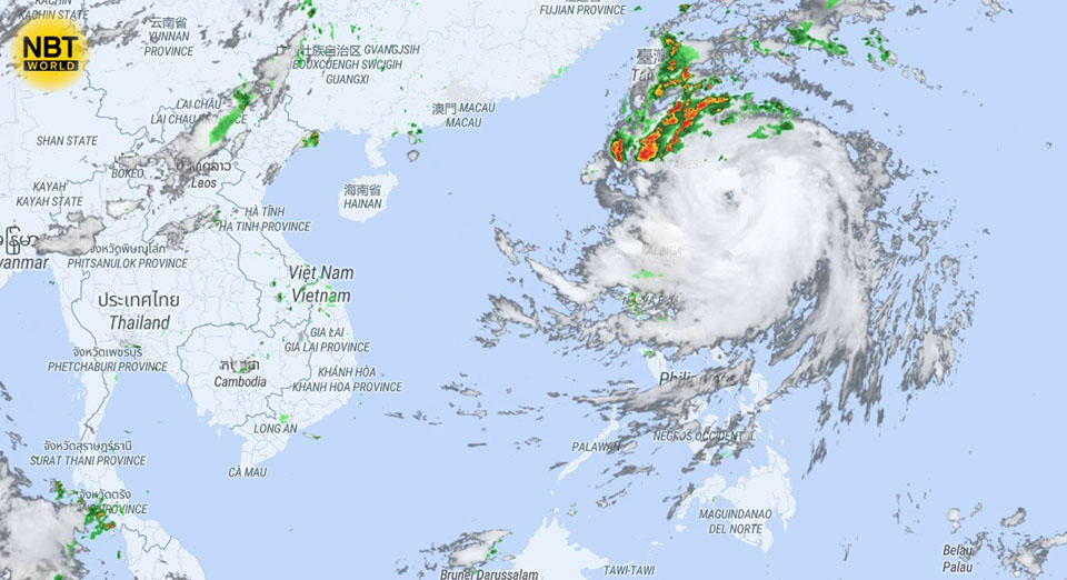
BANGKOK, Thailand – Satellite images from Sunday morning (Sep 29) have indicated an increase in rain clouds and thunderstorms across Thailand’s Northern and Upper Northeastern regions and Bangkok and its surrounding areas. Storm activity is also intensifying around the center of a tropical storm located east of Luzon Island in the Philippines, which is expected to strengthen into a typhoon by the end of the day and track west-northwest towards Taiwan.
In Thailand, the weather instability is driven by a low-pressure system currently over northern Vietnam, combined with fluctuating wind patterns. By Monday, a moderate cold air mass from China is forecasted to move into the region, leading to shifts in wind direction in the northern parts of the country. As the cold air collides with existing warm air, it is expected to generate easterly and northeasterly winds in the North, while westerly and southwesterly winds will prevail over the Andaman Sea.
This convergence is expected to trigger heavy to very heavy rains in the North, Northeast, Central, and Eastern regions, including Bangkok and nearby provinces. The pattern is likely to persist through early October, bringing continuous rainfall to the affected areas.
The Southern region will begin to experience the impact from October 2 to 5, with scattered heavy rains anticipated as the weather system shifts. Residents in at-risk areas are advised to prepare for possible disruptions and localized flooding. (NNT)


