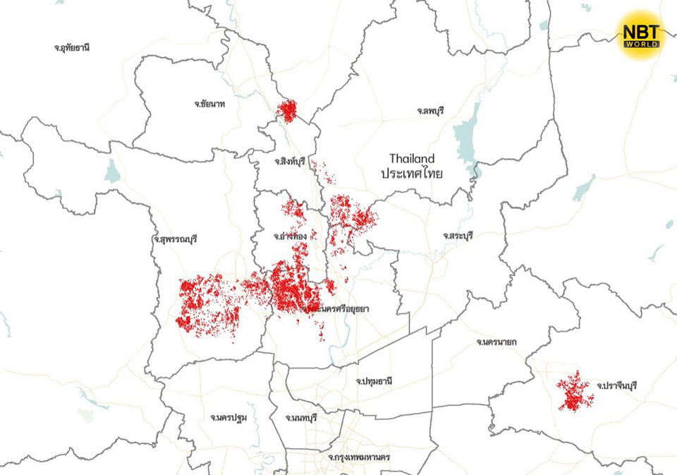
AYUTTHAYA, Thailand – The Geo-Informatics and Space Technology Development Agency (GISTDA) has reported extensive flooding in parts of Ayutthaya province, covering a total of approximately 179,304 rai (71,722 acres) of land as of October 5. The data, obtained through satellite imagery from the Sentinel-1 satellite, indicates that the affected areas include agricultural land, residential communities along riverbanks, and some transportation routes.
The analysis reveals that much of the flooding is concentrated in low-lying agricultural regions, potentially impacting crop production. Residential areas situated along primary and secondary riverbanks are also affected, raising concerns about property damage and accessibility in some parts of the province. The satellite imagery has been shared with local authorities to support their flood response and management efforts.
GISTDA has adjusted its satellite monitoring operations to continue tracking the situation in flood-prone regions and is working closely with responsible agencies to ensure that timely data is available. This information is being used to support planning, monitoring, and management strategies to mitigate the effects of the flooding.
Residents and authorities can access updates and detailed reports on the flood situation across affected provinces through GISTDA’s Disaster Management system at https://disaster.gistda.or.th. (NNT)


