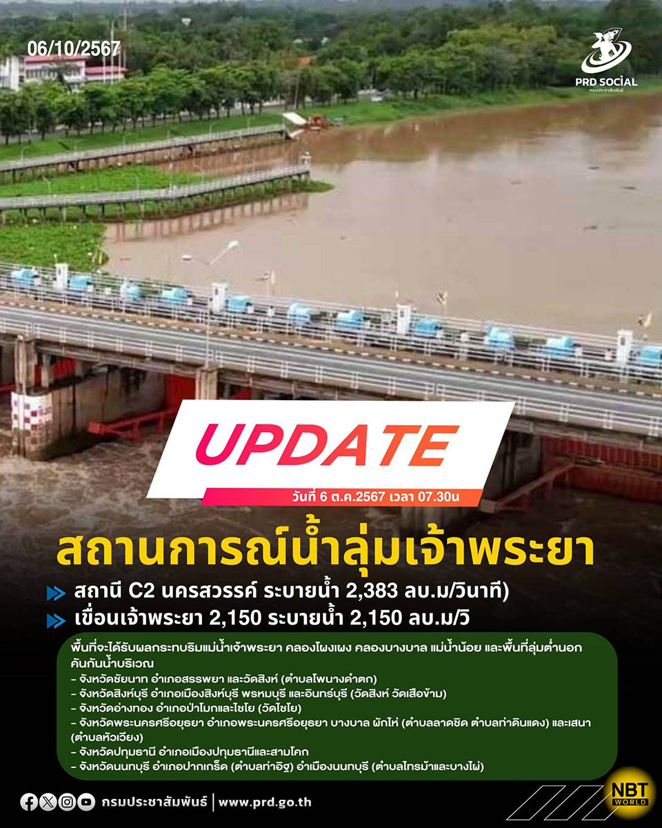
BANGKOK, Thailand – The Royal Irrigation Department has reported rising water levels in the Chao Phraya River Basin, with the flow rate at Nakhon Sawan’s C2 Station recorded at 2,383 cubic meters per second and Chao Phraya Dam in Chai Nat discharging 2,150 cubic meters per second. The increased flow is expected to impact areas along the Chao Phraya River, Phong Pheng Canal, Bang Ban Canal, the Noi River, and several low-lying areas outside flood protection embankments.
At-risk districts include Sapphaya and Wat Sing in Chai Nat, Sing Buri’s Phrom Buri, In Buri, and its capital district, as well as Pa Mok and Chaiyo in Ang Thong. In Ayutthaya, Bang Ban, Phak Hai, and Sena districts are also at risk, along with Sam Khok and the capital districts in Pathum Thani.
Residents in the impacted areas are urged to closely monitor updates and prepare for potential flooding. Authorities have advised precautionary measures, including relocating valuables, livestock, and equipment to safer areas as necessary.
The Royal Irrigation Department will continue to monitor the situation and provide timely updates to residents and local authorities as conditions develop. (NNT)


