The Meteorological Department reveals that rainfall in Thailand is decreasing, but the upper northern and northeastern regions still experience heavy rainfall in some areas. People in these regions are advised to be cautious of the dangers of heavy rain. Meanwhile, Bangkok and its vicinity will have thunderstorms covering 40% of the area.
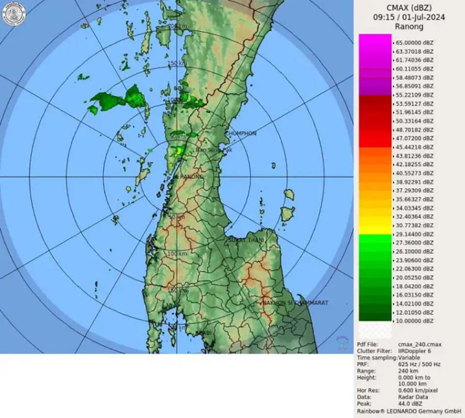
The weather forecast for the next 24 hours indicates that the moderate southwest monsoon covering the Andaman Sea, Thailand, and the Gulf of Thailand is starting to weaken. This condition leads to decreased rainfall in Thailand, but thunderstorms can still occur in some areas. Meanwhile, a low-pressure system covering the upper part of Vietnam causes heavy rain in the upper northern and northeastern regions. People in these areas should be aware of potential dangers from heavy rain during this period.
The waves in the Andaman Sea and the Gulf of Thailand are moderate, with waves about 1 meter high. In areas with thunderstorms, the waves can be higher than 1 meter. Mariners in these areas are advised to avoid navigating in thunderstorm zones.
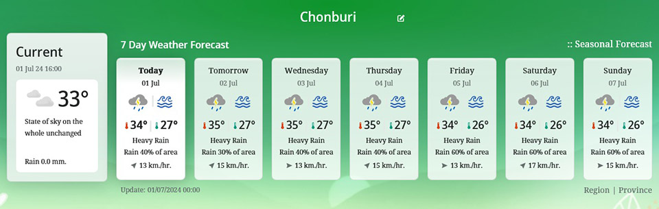
Bangkok and its vicinity will have thunderstorms covering 40% of the area, with minimum temperatures of 26-28 degrees Celsius and maximum temperatures of 33-36 degrees Celsius.


