For decades, NASA has used the vantage point of space, combined with airborne and ground-based field campaigns, to decipher the impact of air pollution and help other agencies protect people when unhealthy air threatens the places they live, work, and play. Now, government agencies in Thailand are harnessing the power of NASA air quality data and expertise through a unique partnership with SERVIR.
Please Support Pattaya Mail
SERVIR, a Spanish word meaning “to serve,” is a joint initiative between NASA and the United States Agency for International Development to boost environmental resilience and decision-making in developing regions around the world. Through its network of regional hubs, SERVIR puts publicly available satellite imagery, geospatial data, and analysis tools into the hands of local decision-makers to help solve their most pressing environmental challenges. The SERVIR-Mekong hub, located at the Asian Disaster Preparedness Center in Bangkok, serves countries in the Mekong River Basin.

To improve air pollution monitoring in Thailand and the lower-Mekong River region, SERVIR-Mekong brought together experts in air quality measurement, technology design, atmospheric modelling, and civic engagement. They include the Royal Thai Government’s Pollution Control Department and Geo-Informatics and Space Technology Development Agency–Thailand’s space agency. Together, they developed a web-based platform for tracking and forecasting air quality in the region.
“Through SERVIR we’re proud to support the Royal Thai Government’s Pollution Control Department in using satellite observations and model outputs to monitor and forecast air quality in Thailand,” said Lawrence Friedl, director of NASA’s Applied Sciences Program. “Partnerships and collaboration are how we create greater on-the-ground impacts that benefit lives on Earth.”
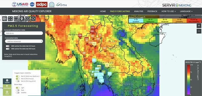
SERVIR-Mekong’s new Air Quality Explorer tool, introduced Nov. 23 at an event in Bangkok, features some major advances over past pollution monitoring systems. The new app combines NASA satellite data, ground-sensor data, and machine-learning techniques to enable large-scale monitoring and forecasting of air quality for the first time in Thailand. Previous systems relied heavily on ground-based technology.
While sensors on the ground can pinpoint local sources of pollution, satellites have proven essential for filling in missing data to provide consistent, near-real time, maps of pollution hotspots that would otherwise be invisible. Satellite observations help scientists and decision-makers see the bigger picture of how air pollution is distributed across the region and how it changes over time.
“Poor air quality is a seasonal problem in Thailand that has persisted for over a decade,” said Steven Olive, mission director of USAID’s Regional Development Mission for Asia. “In addition to providing Thailand with more accurate air pollution readings, this tool also has the potential to address the transboundary challenges that air pollution poses to the region.”
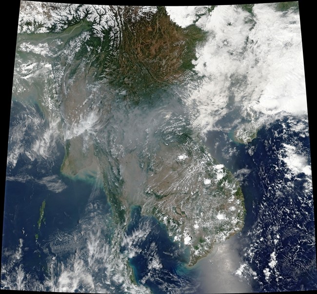
Some of the major sources of pollution, including agricultural burning and forest fires, are a pervasive problem for much of Southeast Asia. Particle pollution becomes worse each year during the dry season, when monsoon rains retreat and colder temperatures and calm winds create favorable conditions for particles to accumulate and linger in the air for a longer period.
Intense smog resulting in unseasonably poor air quality in early 2019 revealed a need for readily available, reliable, and accessible pollution data. Since then, SERVIR-Mekong has put their user-driven development and science expertise to work to improve both monitoring and public awareness. In addition to launching the new tool, the team has held trainings to equip users and even challenged student-innovators to become part of the solution.
“We have stepped into the world of technology,” said Athapol Charoenshunsa, director general of Thailand’s Pollution Control Department. “We look at and understand the world from space through satellite technology. Not only the past and the present, we shall also tell everyone in the future to prepare for environmental pollution properly and effectively.”
Building on the success of the Air Quality Explorer in Thailand, SERVIR-Mekong aims to expand the effort to cover other countries that make up the Association of Southeast Asian Nations in the future.
More about SERVIR
NASA and USAID launched the SERVIR-Mekong hub in 2015 at the Asian Disaster Preparedness Center to serve the countries of Cambodia, Laos, Myanmar, Thailand, and Vietnam. The partnership chiefly supports the development of services to address challenges related to regional water, food security, weather and climate, and land cover and land use.
Established in 2005, SERVIR is also improving awareness, increasing access to information, and supporting data-driven decision-making to help people in West Africa, Eastern and Southern Africa, Hindu Kush-Himalaya, and South America manage environmental challenges.
 |
 |
 |


