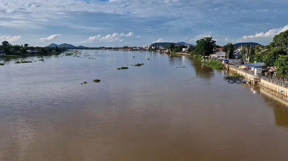
BANGKOK, Thailand –– The Royal Irrigation Department has issued a warning on 26 September to 11 provinces along the Chao Phraya River to prepare for increased water discharge from the Chao Phraya Dam, raising the outflow from 1,500 to 2,000 cubic meters per second.
Mr. Det Lekvichai, Deputy Director-General of the Royal Irrigation Department, acting on behalf of the department’s director, issued the ninth water situation notice on 25 September. The governors of 11 provinces—Uthai Thani, Chai Nat, Sing Buri, Ang Thong, Suphan Buri, Ayutthaya, Lop Buri, Pathum Thani, Nonthaburi, Samut Prakan, and Bangkok—have been informed to prepare for the situation. Relevant agencies and residents along both banks of the Chao Phraya and Noi Rivers are advised to closely monitor rising water levels and be cautious, as water flow from upstream areas has been increasing.
The Royal Irrigation Department forecasts that over the next 1 to 7 days, the water flow at measuring station C2 in Nakhon Sawan will be around 2,000-2,100 cubic meters per second. This flow, combined with side flows of approximately 150 cubic meters per second and an additional 100 cubic meters per second from the Sakae Krang River, will raise the water volume above the Chao Phraya Dam in Chai Nat to 2,350 cubic meters per second. As a result, the discharge from the dam will be gradually increased to 2,000 cubic meters per second. This will cause water levels in low-lying areas outside flood protection barriers, such as Phong Pheng Canal in Ang Thong, Bang Ban Canal in Ayutthaya, and various areas in Sena and Phak Hai districts, to rise by 1 to 1.5 meters, potentially affecting nearby communities.
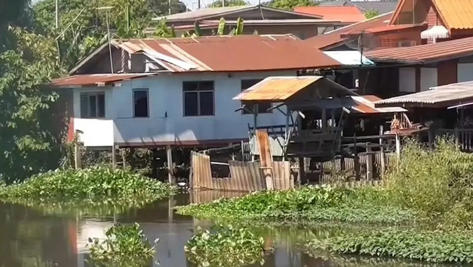
Rising Water Levels in Noi River Cause Concerns
In Ang Thong province, workers at a construction site for a stone-lined embankment along the Noi River in Phai Cham Sin subdistrict are rushing to complete piling work as water levels continue to rise. If the water rises too high, construction will have to be temporarily halted to prevent damage to the flood protection project’s equipment.
The Noi River has seen its second significant rise this month, impacting the flood prevention construction site in Ang Thong. Continuous monitoring of water levels is being conducted 24/7 to avoid potential damage to construction tools and materials.
In Ang Thong, the water level in the Chao Phraya River has risen by nearly 1 meter in the past 24 hours, following the increased discharge from the Chao Phraya Dam. According to the Central Hydrology Center, the water flow rate through the Chao Phraya Dam in Chai Nat is currently at 1,498 cubic meters per second. This has caused the water level at station C7A, located near the Ang Thong Provincial Hall, to rise to 5.99 meters, an increase of 0.82 meters.
The water level in the Noi River at Bang Chak in Wiset Chai Chan district is currently at 3.97 meters, just below the 5-meter flood protection threshold, after rising by 0.30 meters. The Ang Thong Disaster Prevention and Mitigation Office has issued a warning that the Chao Phraya Dam will increase its water discharge to 2,000 cubic meters per second starting 28 September, causing the water level in the Chao Phraya River to rise by 1.00-1.50 meters. Residents in risk areas are urged to stay alert and closely monitor the situation. (TNA)


