Satellite imagery has revealed extensive flooding across several provinces, affecting over 118,000 rai of land, including scores of agricultural areas. The Geo-Informatics and Space Technology Development Agency (GISTDA) reported that the flooding has severely impacted the provinces of Phetchabun, Chaiyaphum, Phitsanulok, Maha Sarakham, and Khon Kaen, with the imagery captured by COSMO-SkyMed-2 satellite on Thursday evening.
The Royal Irrigation Department (RID) is now taking urgent measures to manage water levels in reservoirs exceeding safe capacity in Maha Sarakham. Increased water discharge rates are being implemented, and additional pumps are being deployed to facilitate drainage into nearby rivers and canals.
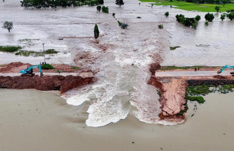
The situation escalated with the breach of Huay Chiang Kham reservoir in Borabue district, which unleashed millions of cubic meters of water, inundating nearly 5,000 rai of farmland downstream in Wapi Pathum district. The floodwaters, reaching two meters in some areas, prompted military intervention to relocate residents to safer locations.
Local authorities in affected regions said the situation is being closely monitored, advising residents to stay informed of developments. Meanwhile, efforts to repair damaged infrastructure, such as weirs in Chaiyaphum’s Nong Bua Rawe district, are underway, with officials planning to request funding for more permanent solutions. (NNT)


