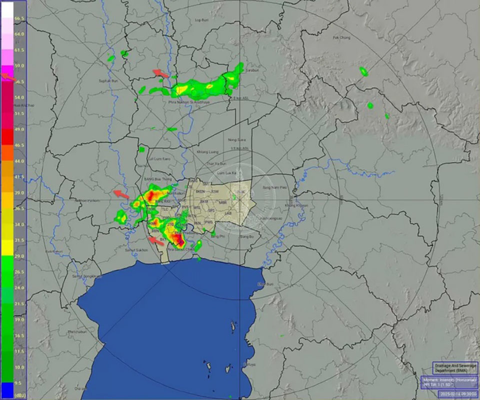
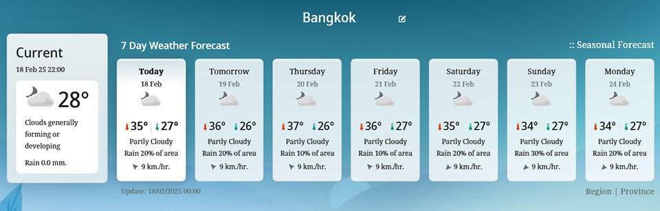
BANGKOK, Thailand – The Thai Meteorological Department has issued a weather warning for Bangkok and surrounding provinces, forecasting thunderstorms covering 40% of the area, with some regions experiencing strong winds. Additionally, the southern region is expected to see increased rainfall, and the waves in the Gulf of Thailand will be stronger.
The forecast for the next 24 hours indicates that a moderate high-pressure system will cover the Northeast and South China Sea, leading to moisture from the South China Sea and the Gulf of Thailand affecting the northern, northeastern, central, eastern regions, as well as Bangkok. These conditions, combined with daytime heat, will bring thunderstorms, gusty winds, and possible lightning strikes in certain areas. Temperatures are expected to drop by 1-2°C in the Northeast.
Residents are advised to stay cautious of these sudden weather changes, avoid open areas, tall trees, weak structures, and advertising billboards. Farmers should also take necessary precautions to protect crops from potential damage.
Meanwhile, the moderate northeastern monsoon will strengthen in the Gulf of Thailand and the South, bringing increased rainfall. In the lower Gulf of Thailand, waves will be between 1-2 meters, while the upper Gulf of Thailand will see waves of around 1 meter. In areas with thunderstorms, waves could reach over 2 meters. Boat operators in the Gulf of Thailand and Andaman Sea are urged to proceed with caution and avoid areas with thunderstorms. (TNA)


